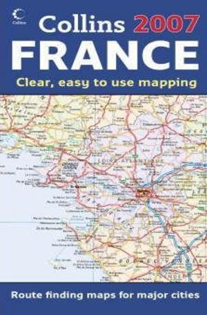
Map of France 2007
This is the new edition of annually revised, politically coloured map of France. It is the ideal map for planning and route-finding. It is on the scale of 1 : 1 125 000 (1cm to 11 kms / 1 inch to 18 miles). The area of coverage is from the Belgian and German borders in the north to the Spanish border in the south, and from the Brest Peninsula in the west to the Italian and Swiss borders in the east. It also includes the island of Corsica. The map details include politically coloured mapping showing individual departments by name, motorways, roads, airports, cities and towns. The Motorways and Euroroutes are numbered. It includes Through-route map of Paris, Lyon, Marseille, Strasbourg, and Toulouse; Distance chart giving distances in kilometres between main towns; Key to Department names and numbers, and list of Regions; Internet links to further information; Map legend in English, French and German; and Index to place names. The product is aimed at home and business reference users. Other products in the series include: "2007 Map of Europe", "2007 Map of Britain", "2007 Map of Scotland", "2007 Map of Ireland", and "2007 Map of France".
Kниги от същия жанр
-

The Puffin Book of Christmas Storiesпечатна:
6.08 EUR
11.90 лв. -

The Lathe of Heavenпечатна:
7.10 EUR
13.90 лв. -

Russian Criminal Tattoo Encyclopaedia: v. 3печатна:
17.84 EUR
34.90 лв. -

The Location Sound Bibleпечатна:
21.72 EUR
42.50 лв. -

Bulgariaпечатна:
18.86 EUR
36.90 лв. -

On Her Majestys Secret Serviceпечатна:
8.18 EUR
16.00 лв. -

Globes in a Boxпечатна:
20.40 EUR
39.90 лв. -

The Rough Guide to Italyпечатна:
21.47 EUR
42.00 лв. -

Knife of Dreamsпечатна:
11.70 EUR
22.90 лв.


То е много важно за нас, затова може да ви бъдем от полза като ви дадем следните насоки:
Резюме: Моля опишете вашето общо впечатление от продукта в няколко думи.